


étape une de St Régis

Regisconraud
User

Length
19.3 km

Max alt
991 m

Uphill gradient
704 m
Km-Effort
28 km

Min alt
624 m

Downhill gradient
389 m
Boucle
No
Creation date :
2025-04-06 04:56:28.661
Updated on :
2025-04-06 14:20:42.59
6h09
Difficulty : Very difficult

FREE GPS app for hiking
 SityTrail
IGN / Geographical institutes
SityTrail Plus
The world is yours!
About
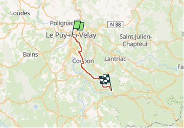
Trail Walking of 19.3 km to be discovered at Auvergne-Rhône-Alpes, Haute-Loire, Le Puy-en-Velay. This trail is proposed by Regisconraud.
Positioning
Country:
France
Region :
Auvergne-Rhône-Alpes
Department/Province :
Haute-Loire
Municipality :
Le Puy-en-Velay
Location:
Unknown
Start:(Dec)
Start:(UTM)
569960 ; 4987867 (31T) N.
Comments